If the forecast holds, rainfall activity is expected to pick up during the first week of July, allowing the monsoon to advance more rapidly.
The India Meteorological Department (IMD) said conditions are favourable for the southwest monsoon to advance further into parts of Gujarat, Madhya Pradesh, Chhattisgarh, Jharkhand, Bihar, Uttar Pradesh and Uttarakhand over the next three to four days.
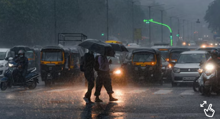
Even so, many parts of North India are yet to receive widespread rainfall, raising a common question: if the monsoon is advancing, why hasn’t it started raining?
The key reason is that the advance of the monsoon and widespread rainfall are not the same.
Latest INSAT-3DS satellite images show dense monsoon cloud cover over central India, the Bay of Bengal, the northeast and parts of southern India. In contrast, Delhi-NCR, western Uttar Pradesh, Haryana, Punjab and Rajasthan continue to remain under largely clear skies.
This indicates that while the monsoon circulation is moving northward, the rain-bearing weather systems required to produce widespread showers have not yet formed over these regions.
The IMD says the official advance of the monsoon is based on changes in wind patterns, moisture levels and sustained rainfall across a broad region, rather than rainfall occurring simultaneously in every district.
As a result, the monsoon can officially enter a state while several cities continue to witness hot and dry conditions for a few more days.
According to the meteorologists, the current delay is mainly due to the absence of strong low-pressure systems over the Bay of Bengal. These systems drive the Indian monsoon by drawing moisture inland and spreading rainfall across central and northern India.
Without them, the moisture-laden southwesterly winds remain relatively weak, resulting in scattered rather than widespread rainfall.
There are, however, indications that conditions may improve soon.
Weather models suggest a large tropical weather system is developing north of the equator over the eastern Indian Ocean. It is expected to move into the Bay of Bengal over the next four to seven days, strengthening the monsoon flow.
Its movement could lead to the formation of a low-pressure area over the Bay of Bengal and possibly a middle-tropospheric vortex over western India.
Both systems typically enhance moisture transport and can significantly boost rainfall across central, western and northern parts of the country.
If the forecast holds, rainfall activity is expected to pick up during the first week of July, allowing the monsoon to advance more rapidly across the remaining parts of northwest India, including Delhi-NCR.